Mound Cemetery
Warren Township
Jefferson County, Ohio
Photo's of newspaper articles and cemetery located in the Jefferson County Lines Newsletter, Winter 2009 Issue. The Mound Cemetery located in Tiltonsville, Warren Township, Jefferson County, Ohio. It was taken prior to November 1, 1959 when it appeared on page 13 of the Wheeling Times-Leader Newspaper
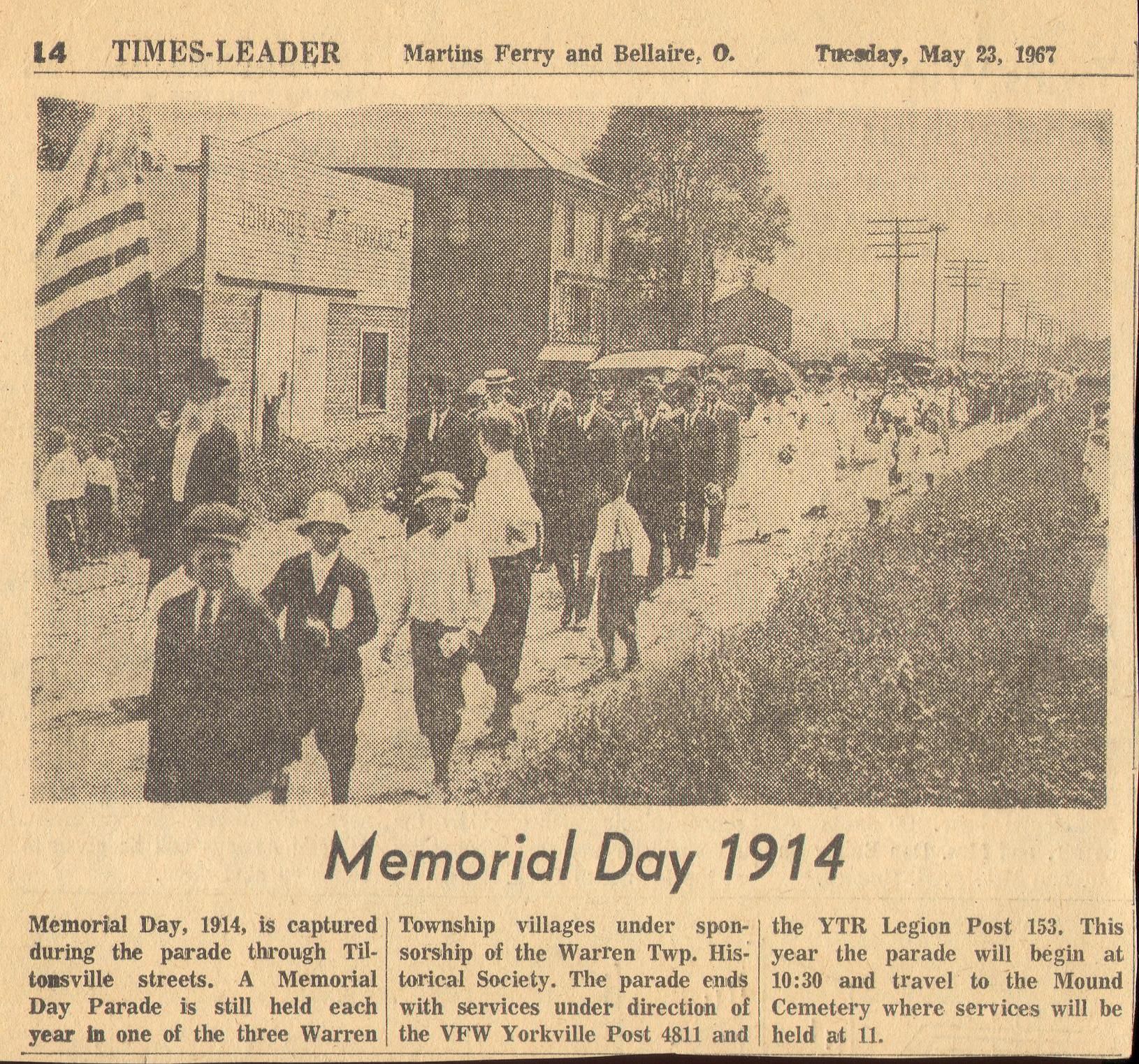
May 28, 1971 Times-Leader Newspaper
L to R: Franklin Van Hove,
Master of the ceremony and Robert
Richardson, President of the Warren Twp.
Historical Society… conducting Memorial
Day services at the Mound Cemetery
Above photo donated by Mr. Robert Richardson.
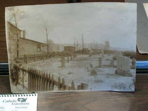
The picture if a photo of the Mound Cemetery taken in 1920. It shows the eastern section of the James Hodgens plot surrounded by iron pipes.
The house on the left was occupied by the Billingsly family for many years, and the picket fence has been replaced by a well-worn chain-lock fence.
Historical Indian Mound
Mr. Robert Richardson, a lifetime chapter member, friend, and local author and historian has devoted much of his life to the history of Jefferson County, Warren Township, the Tilton family and the Mound Cemetery in Tiltonsville, Warren Twp. Ohio.
When Robert explored the Mound cemetery in 1975, there were 88 headstones surrounding the mound. He states that Susannah Tilton, the wife of John Tilton who died in 1838, had a beautiful headstone, but it has disappeared. The oldest confirmed pioneer burial in the cemetery is Susan Tilton, a baby daughter of John and a Susannah, who died in 1792. There was also a marker for her, but it is gone. John, the founder of Tiltonsville and a patriot of the American Revolution, died in 1810 and is buried beside his wife in this cemetery. John Tilton, Jr., a son of John and Susannah who died in 1831, is the only visible Tilton marker at the present time.
The Times-Leader newspaper dated June 21, 1987: Three university students of Steubenville removed grass and dirt from atop the first tombstone uncovered. The grave marker measured 22 ¾ inches by 47 inches. They placed the marker into the base to see if it would into the grooved base, but the fit wasn’t just right. The tombstone was taken to the university to be recorded, measured and examined. Once each marker has been cataloged and studied it will be brought back to the mound and places as near to the original grave site as possible.
(Times Leader newspaper, June 21, 1987)
(Editor’s comments) While reading Mr. Richardson’s remarks, concerning the headstones that he saw in 1975, when he visited the cemetery, we compared his list to the newspaper article that was written in 1987. The statement about, “the tombstones were taken to the university to be recorded, measured and examined.” We wonder if those headstones were ever brought back to the cemetery and repaired/reset? We note that many tombstones were missing from that point.
The following was compiled and written by Mr. Robert Richardson on May 15, 2008:
- One the National Register of Historic Places – 1975
- The cemetery is a perfect octagon with 8 equal sides 90 feet long. It contains 1 acre of ground.
- In the center is a large, conical-shaped mound which was built by the Adena Indians. The mound is about 13 feet high, with a diameter of 80 feet at the base.
- The Adena people were a prehistoric culture that lived here in the Valley about 2,000 years ago, between 400 B.C. and 700 A.D. They were intelligent and peaceful. They lived in circular dwellings made of poles covered with bark. They made ornaments such as bowls and pipes, out of clay, stone and copper.
- The Adenas were the first to design and build burial mounds. After a man died, he was arranged at the burial site, and everyone carried baskets of dirt and piled it on the body.
- The mound has never been explored scientifically. When the west side severely eroded, pieces of bone, copper, mica, and a human skull was found. It is suppose to be in the Martinsferry Historical Society’s Museum. The maple tree on top of the mound was planted in 1898.
- In 1832, James Hodgens came from PA and bought 400 acres of land which included all of Highland City, part of Rayland and also the Mound Cemetery. He converted the cemetery in what he called the “Old Family Graveyard” and fenced it in. He reserved a section within the octagon with locust posts and timbers. James Hodgens died in 1856 and he and all of his family are buried in the family plot.
- When I explored the cemetery in 1975, there were 88 headstones surrounding the mound. I know some have been lost since then. (Note comments under photo.) The John Tilton Jr., marker was recently removed so it can be repaired by the village of Tiltonsville during a cemetery cleanup conducted by them with the Jefferson County Chapter, OGS.
- On October 19, 2006, the SAR from the Ebenezer Zane Chapter installed a bronze marker at the Mound in honor of John Tilton for his service as a Patriot and Virginia Militiaman during the American Revolution. Tilton was at Fort Henry in Wheeling when it was besieged by the Indians in 1777 and 1782. There are also 3 known Civil War veterans buried at the cemetery, and 2 slaves of the Hodgens family.
- The last deed to the Mound Cemetery is dated April 1, 1861 and is signed by Isaac N. Hodgens, a son of James, and his wife, Mary. This deed transferred ownership of the Mound cemetery to the public forever.
NOTE – In about 1960, the western side of the Mound was severely eroded, and a number of artifacts were flushed out from the prehistoric mound. A local contractor hauled 44 truckloads of top soil and spread it to fill the erosion.
Follow the newspaper trail:
Times Leader Newspaper
November 1, 1959
May 23, 1967
May 28, 1971
June 21, 1987
The following was written by Mr. Robert Richardson in an email to Flora -
Thomas Tilton, the second son of John & Susannah Jones Tilton, was born in 1768 near the present city of Washington, PA. He married first Sarah (surname unknown) and had a daughter, Rose Ann, born in 1803. Rose Ann married James Aken on August 7, 1819 and died between 1844 & 1850. Thomas also had a son, John, born in (1807) who married Sarah Rud on January 18, 1837. Sarah Rud Tilton died on October 14, 1875. Sarah Tilton, the first wife of Thomas Tilton, died before1810. Thomas Tilton's second marriage was to Rosanna Hindman on December 4, 1810. They had three children: Drusilla was born in 1811 and married Rezin Wheeler on June 29, 1837; James was born in 1815 and married Jemima Higgins; and Thomas was born in 1817 and married Mary Jane Pennel, and died in a Confederate prison on February 17, 1865.
The Mound Cemetery is located in the center of Tiltonsville on Arn Avenue. We know that John & Susannah Tilton and their children: Thomas, John, Jr., and Susan are buried there.

Photo above is of the Mound Cemetery,
Tiltonsville, Warren Township,
Jefferson County, and was taken prior to
November 1, 1959 when it appeared on
page 13 of Wheeling Times-Leader
Newspaper
|

May 28, 1971 – L to R: Franklin Van
Hove, master of the ceremony and Robert
Richardson, president of the Warren Twp.
Historical Society… Conducting Memorial
Day services at the Mound Cemetery, Tiltonsville, Ohio.
|
DEED INFORMATION
-
James Hodgens purchased land which included the Mound Cemetery in 1834
-
Deed transferred to the public in April 1, 1861 forever
|
|
|
Click the following to view larger version. |

1st pic - Mound Cemetery, not dated |

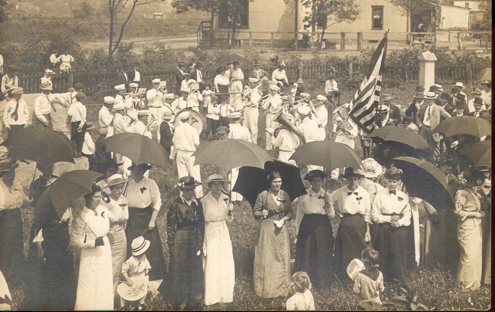
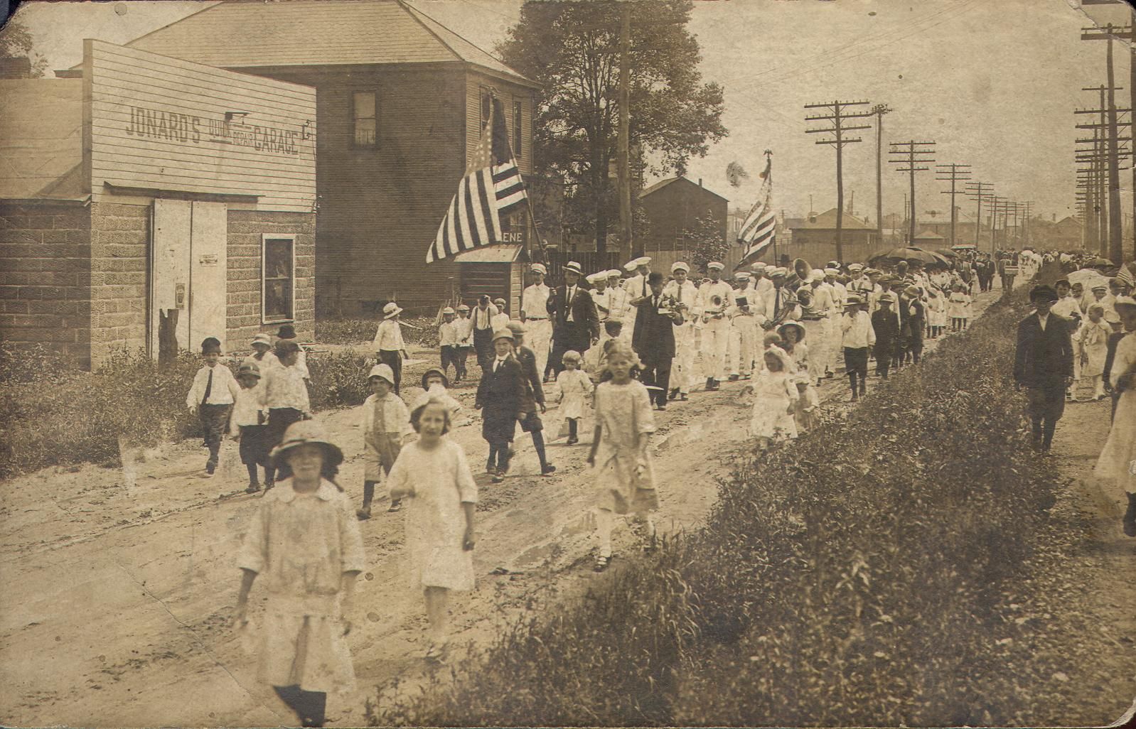
2nd pic - Memorial Day parade to the Mound Cemetery, Tiltonsville, Ohio |

3rd pic - Tiltonsville, Ohio, Memorial Day Parade newspaper article |
|